

📊 Full opportunity report: Could StreetComplete’s Quest Format Bring More Detail To OpenStreetMap? on IdeaNavigator AI — validation score, market gap, and execution plan.
TL;DR
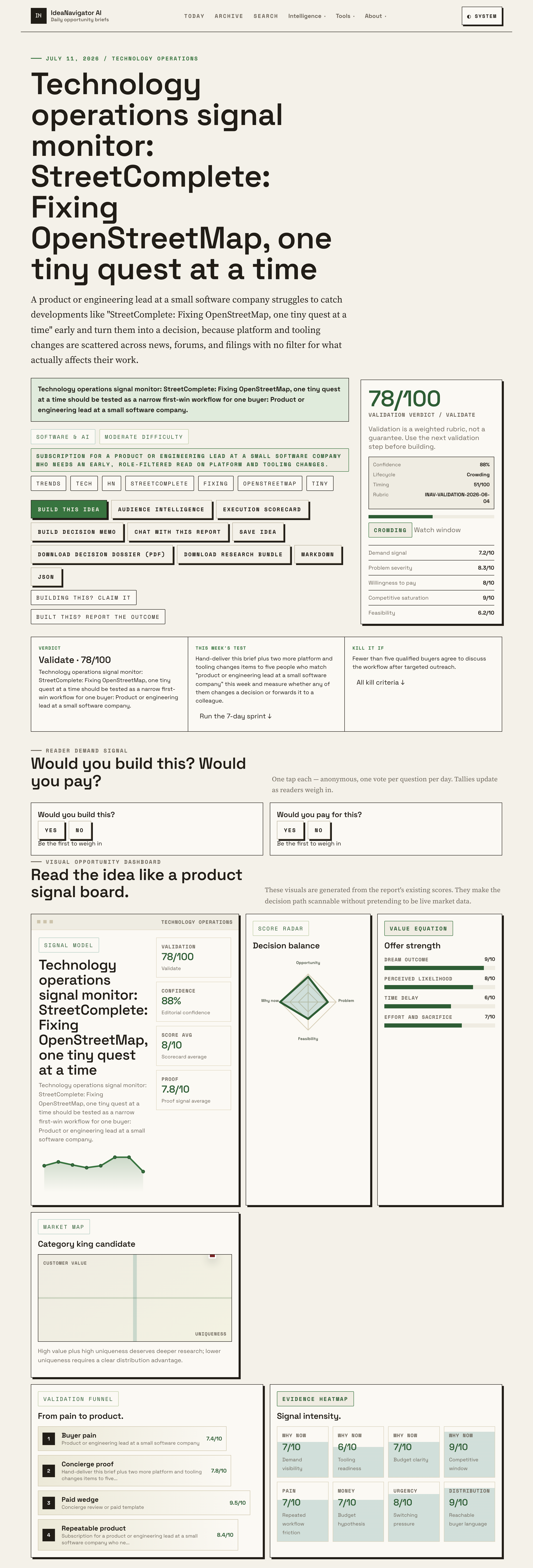
StreetComplete, a mobile app that turns OpenStreetMap editing into small, guided ‘quests,’ resurfaced on Hacker News with a high interest signal, per IdeaNavigator AI. The discussion highlights how quest-style micro-contributions could improve map detail, though many questions about scaling and coverage remain unresolved.
The Android app StreetComplete, which structures OpenStreetMap contributions as small, single-question “quests,” drew renewed attention this week after a Hacker News discussion titled StreetComplete: Fixing OpenStreetMap, one tiny quest at a time registered an engagement signal of 88 out of 100, according to IdeaNavigator AI, a platform that tracks technology and tooling developments. The renewed visibility has prompted fresh conversation about whether the app’s quest format — asking users one targeted mapping question at a time, such as whether a shop still exists or what surface a path has — could meaningfully increase the detail and freshness of OpenStreetMap data.
StreetComplete is a free, open-source application that presents users with location-based micro-tasks, or “quests”. Rather than asking contributors to learn the full OpenStreetMap editing interface, the app detects missing or outdated attributes near a user’s location and asks a single, answerable question — for example, the opening hours of a restaurant, the presence of a bicycle rack, or the surface type of a footpath. Answers are submitted directly to OpenStreetMap without the user needing to understand the underlying tagging system.
The format is designed to lower the barrier to contribution. Traditional OpenStreetMap editing requires familiarity with editors such as JOSM or iD and with the project’s tagging conventions. StreetComplete removes that requirement, which its community argues makes it well suited to casual contributors and to filling in large volumes of small data gaps that experienced mappers often deprioritize.
The recent Hacker News attention, flagged by IdeaNavigator AI’s technology operations signal monitor, positioned the discussion as relevant to product and engineering leads at small software companies who track how platform and tooling ecosystems change. The signal-monitoring service rated the item 88 out of 100, indicating high relative interest compared with other developments it tracks in the same window. The exact discussion date and final comment volume were not independently confirmed at the time of writing.
Why Quest-Style Mapping Matters for Data Quality
OpenStreetMap underpins mapping features in many commercial and civic applications, from routing services to humanitarian response tools. Its weakness has never been the base road network in well-mapped regions but the long tail of attributes: accessibility details, pedestrian infrastructure, shop statuses, and surface types. These attributes are exactly what StreetComplete’s quests target, which is why the format is frequently discussed as a model for crowdsourced data maintenance at scale.
For software teams, the discussion also illustrates a broader product-design pattern: decomposing a complex contribution workflow into narrow, context-aware micro-tasks. IdeaNavigator AI framed the StreetComplete thread as a case where a role-filtered, same-day read of a tooling development can inform decisions faster than waiting for aggregated industry roundups. Whether the quest model translates to domains outside of mapping remains an open question, but the attention the thread received suggests sustained interest in the pattern.
StreetComplete’s Track Record in OpenStreetMap
StreetComplete has existed as an open-source project for several years and is maintained by a volunteer community. It is one of several contribution tools in the OpenStreetMap ecosystem, sitting alongside full-featured editors and specialized apps for specific data types such as sidewalks or opening hours.
The app has historically been credited with driving high-volume, low-complexity edits, particularly in urban areas where foot traffic generates a steady supply of quest answers. The OpenStreetMap community has at times debated how quest-driven edits interact with broader mapping quality standards, since contributors answer questions without seeing the full editing context. Those debates are longstanding and were not newly resolved by this week’s discussion.
Open Questions About Scaling the Quest Model
Several points remain unclear. The engagement signal of 88/100 is a proprietary scoring from IdeaNavigator AI; the methodology behind the score and the size of the underlying Hacker News discussion were not disclosed. It is also not confirmed whether the thread introduced any new app features, version releases, or usage statistics — the available material describes the discussion, not a product announcement from the StreetComplete maintainers.
Beyond the thread itself, it remains an open question whether the quest format can address coverage gaps in sparsely mapped regions, where foot traffic is low and quests are rarely triggered. No data was presented in the surfaced discussion quantifying StreetComplete’s effect on overall OpenStreetMap data quality, and any claims about its impact should be treated as community interpretation rather than measured outcomes.
Where the Mapping Conversation Goes From Here
Readers can watch for new StreetComplete releases, which are published through the project’s open-source repository and app stores, and for any usage or edit-volume statistics the maintainers publish. The OpenStreetMap community’s ongoing quality discussions — visible through the project’s community forums and mailing lists — will indicate whether quest-driven contributions continue to be integrated into mainstream mapping workflows. IdeaNavigator AI’s own next step, according to its validation plan, is to test whether briefs of this kind change decisions for a small group of product and engineering leads.
Source: IdeaNavigator AI
Key Questions
What is StreetComplete?
StreetComplete is a free, open-source Android app that lets users contribute to OpenStreetMap by answering simple, location-based questions called quests, without needing to learn a full map editor.
Why did StreetComplete get attention this week?
A Hacker News discussion about the app registered an 88/100 engagement signal on IdeaNavigator AI’s technology operations monitor, renewing conversation about quest-based contribution models.
Does StreetComplete improve OpenStreetMap data quality?
The community generally credits it with filling in small data gaps at high volume, but no quantified impact data was presented in the recent discussion, so claims about overall quality effects remain interpretive.
Can I use StreetComplete outside cities?
Yes, but quests depend on nearby missing map data and foot traffic, so rural and sparsely mapped areas typically generate fewer quests than urban environments.
Is the quest format applicable beyond mapping?
It is discussed as a general pattern for decomposing complex contributions into micro-tasks, but no evidence was presented that the model has been validated in other domains.
Source: IdeaNavigator AI